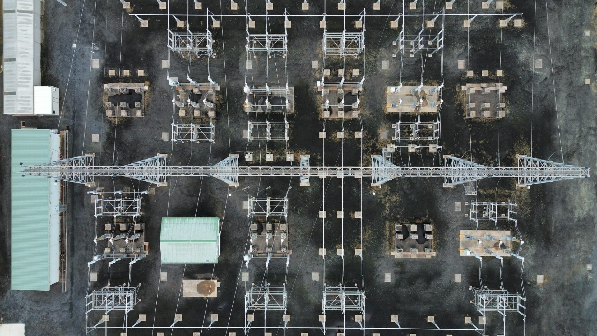
Power lines stretch across mountains, forests, and populated areas. Sometimes, inspectors cannot easily reach locations in order to identify damaged components. Power line inspections using drones allow utility crews to examine elevated infrastructure using specialized cameras and aerial imaging technology. With artificial intelligence entering the inspection process, these systems have the power to change how companies assess electrical equipment and plan maintenance.
Why Do Utility Companies Use Drones?
Standard power line inspections involve ground patrols, bucket trucks, and helicopters, depending on the location and condition of the electrical infrastructure. Although these methods remain valuable, accessing transmission towers in mountainous terrain or examining equipment above dense vegetation presents significant challenges. Drones provide an aerial perspective without requiring inspection personnel to climb structures or enter potentially hazardous locations.
Equipped with specialized imaging technology, drones capture detailed photographs of electrical components from carefully selected positions. Inspection teams review this information to identify visible damage and determine whether equipment requires maintenance. Drones are particularly useful when companies must examine extensive stretches of infrastructure following severe weather or investigate suspected damage in remote areas.
How Drones Capture Power Line Inspection Data
Professional inspection drones typically carry stabilized cameras that capture images of overhead conductors, transmission towers, and electrical hardware. Operators control the aircraft’s position and camera angle to document specific components without approaching energized equipment unnecessarily. The resulting photographs provide detailed records that inspection teams will reference.
High-Resolution Cameras Recognize Physical Damage
Modern drone cameras capture detailed images that reveal deterioration across electrical infrastructure. With sufficient resolution and appropriate viewing angles, inspectors can find cracked insulators, corroded fittings, damaged conductor strands, and loose hardware.
Camera zoom capabilities allow operators to examine elevated components from a distance. However, image quality depends on lighting conditions, movement, and the aircraft’s position. Inspection teams must collect sufficiently detailed photographs to distinguish genuine equipment defects from shadows or surface contamination.
GPS Technology Documents Inspection Locations
Global Positioning System (GPS) technology assists drones in navigating inspection routes and associating captured images with geographic locations. Accurate location records reveal transmission structures when planning repairs or conducting subsequent inspections.
Some professional systems incorporate automated flight planning to capture consistent views of infrastructure across repeated surveys. However, operators must account for nearby electrical equipment, potential signal interference, and applicable aviation restrictions when navigating these environments.
Drones Detect Electrical Issues
Electrical equipment produces heat as current flows through conductors and connections. Excessive electrical resistance at a deteriorating connection generates abnormal heating, creating a temperature disparity between affected equipment and surrounding components. These changes aren’t necessarily visible through conventional photography, making specialized imaging technology valuable for assessing electrical infrastructure.
Thermal imaging cameras detect infrared radiation and translate temperature differences into visual representations. During an inspection, operators examine these images for unusual heat patterns around electrical connections.
Locating Abnormal Heat Patterns
A loose or deteriorating electrical connection might increase resistance and concentrate heat around a particular component. Locating irregularities without physically contacting energized infrastructure is possible with the use of thermal cameras. When inspectors encounter an unusual temperature pattern, they can compare the affected component with nearby equipment operating under similar electrical conditions.
However, temperature alone doesn’t establish whether equipment has failed. Electrical loading, sunlight, wind, and surface characteristics influence thermal readings. Inspectors must evaluate these conditions before determining whether a suspicious temperature pattern indicates a maintenance concern.
Utilize AI To Analyze the Collected Data
Inspecting extensive electrical networks generates thousands of photographs and thermal images, creating a substantial workload for inspection teams. Artificial intelligence processes the data using computer vision, a technology that enables software to recognize objects and visual patterns. Instead of examining each image individually, AI-assisted systems flag concerning areas for the team to investigate further.
These systems rely on machine learning algorithms trained with examples of electrical components and known equipment defects. The software examines newly collected images for patterns resembling those in its training data. However, its effectiveness depends on image quality, training data, and the types of problems it has learned to recognize.
Pinpointing Visible Equipment Defects
When analyzing high-resolution photographs, AI software searches for visual characteristics associated with damaged electrical equipment. For example, an algorithm trained to recognize insulator defects might reveal cracks or missing sections that suggest deterioration.
The software flags suspicious images and associates them with inspection locations, guiding maintenance teams to the components that demand evaluation. Nevertheless, reflections, shadows, and unfamiliar equipment designs can produce inaccurate classifications. Qualified inspectors must review these findings before confirming equipment damage.
Detecting Unusual Thermal Patterns
Beyond conventional photographs, AI-assisted software examines thermal images for abnormal temperature distributions. Algorithms compare temperature patterns across electrical components to identify areas that differ from expected operating conditions.
For instance, a connection displaying significantly elevated temperatures compared with similar components might receive a flag for additional inspection. The software organizes the findings according to predefined criteria, allowing maintenance teams to prioritize potentially serious concerns.
However, automated thermal analysis cannot independently determine the cause of every temperature abnormality. Environmental conditions, camera calibration, and electrical loading influence the results. Inspectors must interpret AI-generated findings alongside operating information and other inspection evidence.
Drones Inspect Vegetation Near Power Lines
Trees growing near overhead conductors present a significant concern for electrical utilities. Branches approaching energized lines may contribute to electrical faults, particularly when wind or severe weather causes vegetation to move.
Drones equipped with cameras help inspection teams document vegetation near transmission corridors. Some systems use light detection and ranging (LiDAR), which measures distances using reflected laser pulses, to produce three-dimensional representations of surrounding terrain and vegetation. These measurements help utilities evaluate clearance distances and note locations requiring vegetation management.
Unlike photographs, LiDAR information provides spatial measurements that assist with evaluating proximity to electrical infrastructure. However, reliable results depend on survey quality, accurate processing, and appropriate clearance standards.
What Limits Drone-Based Power Line Inspections?
Despite their capabilities, drones cannot replace every conventional inspection method. Severe wind, rain, and poor visibility prevent safe flights or compromise image quality. Battery capacity also limits flight duration, requiring operators to plan inspection routes around available power and operating conditions.
Electrical infrastructure introduces additional complications because energized conductors, electromagnetic interference, and nearby obstacles demand careful flight planning. Aviation regulations may restrict operations near certain locations or beyond an operator’s visual line of sight. These restrictions influence where drones operate and how inspection teams collect footage around power lines.
Furthermore, aerial cameras cannot directly measure voltage or confirm every electrical fault. Inspection teams must sometimes investigate suspected problems through specialized testing using appropriately rated instruments. Electrical testing involves principles of voltage sensing and isolation that are also relevant to high-voltage accessories for system integration in compact electronic systems. Proper isolation prevents high electrical potential from reaching sensitive measurement circuitry, while correctly rated instruments allow technicians to evaluate electrical conditions beyond what aerial images reveal.
The Future of Drone Technology
Drone technology is becoming a valuable resource for utility companies that maintain extensive electrical networks. Detailed aerial imagery identifies deteriorating components and examines difficult-to-access infrastructure so that crews are able to repair the system accurately.
As automated navigation, advanced sensors, and artificial intelligence continue developing, power line inspections using drones could become increasingly consistent and efficient. Improved image analysis and repeated aerial surveys help utility companies recognize developing equipment problems promptly, giving maintenance teams valuable information to guide repairs and protect electrical service reliability.